Garmin Standard Mapping® - Texas East Professional microSD™/SD™ Card
-
Estimated Delivery :Nov 30 - Dec 04
-
Transit Time : Transit Time for this product is around 2 - 4 days.
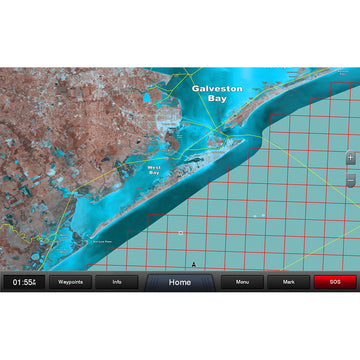
Garmin Standard Mapping® - Texas East Professional microSD™/SD™ Card
Standard Mapping® - Texas East Professional microSD™/SD™ Card
Statewide coastal aerial overlay provides high-resolution imagery, local names of waterways and land features, outlined Wildlife Management Areas and Offshore Lease Areas plus added value from Standard Mapping's pro staff.
Oyster Leases
Outlines these areas in white.
Artificial Reef
Identifies these with a white dot.
State and Federal Offshore Boundaries
See exactly when crossing between state and federal waters.
 WARNING: This product can expose you to chemicals which are known to the State of California to cause cancer, birth defects or other reproductive harm. For more information go to P65Warnings.ca.gov.
Top Brands
